
I always wanted to explore Yellowstone in depth. All these amazing images of geysers, colorful hot springs, expansive wide-open areas in the backcountry – I was so hooked. While I lived in Hawai’i and worked as a lava tour guide I never had enough time off for a mainland trip. So Yellowstone was not an option. 2018 changed everything. Our volcano went nuts, burned my house, and took all my jobs and I was forced to move back to the mainland, mainly for health reasons. Still healing of what I experienced, both physically and psychologically hurt, I decided I needed this trip now. I booked several campsites in the park, so I could split up my visit to several areas and I was more than ready to go.
The trip itself was more than rewarding to me. It was a trip to heal, recover, and push to new limits. It was a trip needed.
I split the report into three parts. As much as I did during my time in Yellowstone. Three separate areas and campgrounds. I covered a lot of ground. Mostly in the backcountry on solo day hikes, but also in the typical touristy areas. I was not disappointed at all.
Part I – Mammoth Area
September 6:
After spending the night before at Bryce Canyon and hanging out with my friend who worked there as a park ranger, I left Bryce around 4 pm and headed north towards Yellowstone. My goal was to get as close as possible to the park and camp somewhere nearby so I could head into the park as soon as possible the next morning to snag a campsite at Mammoth campground which was first come first serve. I had checked the Yellowstone app for the last few days and saw that even Mammoth filled up pretty early. On my way up North, I stopped near Ogden and met with Chere at a local Harmons store. I had bought a nice 0-degree car camping sleeping bag from her as most of my camping gear was non - existent at this point. It was good to see her and we had a short small talk. I continued on my journey north, through Idaho. Before my trip, I had researched a lot of free camping options and hoped to find one this late. I passed Island Park and turned off onto a dirt road. I was able to get a free camp spot and finally went to sleep at 2 am.
September 7:
I got up at 5 am, had a coffee, and drove the last 20 miles to the park entrance. I was finally in Yellowstone!!! I didn’t stop along the way to Mammoth, even though it was super tempting. The primary goal was to get a campsite. There was a road construction between Norris and Mammoth and all traffic stopped for almost 40 minutes. I definitely had to consider that when I wanted to explore the area a bit more. At Mammoth, there was already a line of cars at the fee station but I was able to get a nice campsite. I felt relieved. It didn’t take too long to pitch my tent and after I was done I had a nice breakfast and was finally able to relax.
I’m in Yellowstone, nothing to worry about from now on.
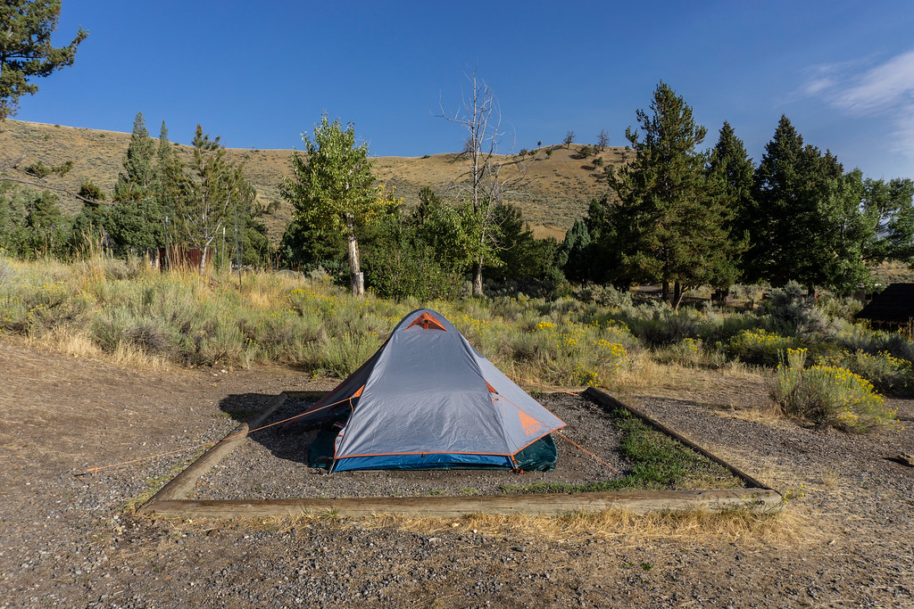
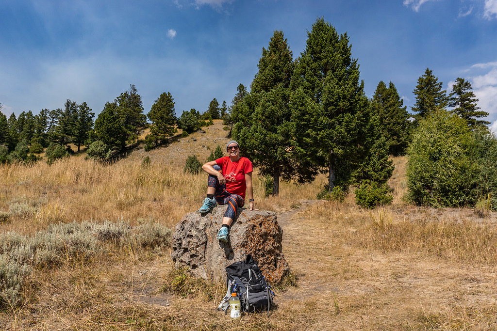
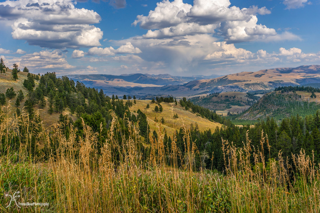
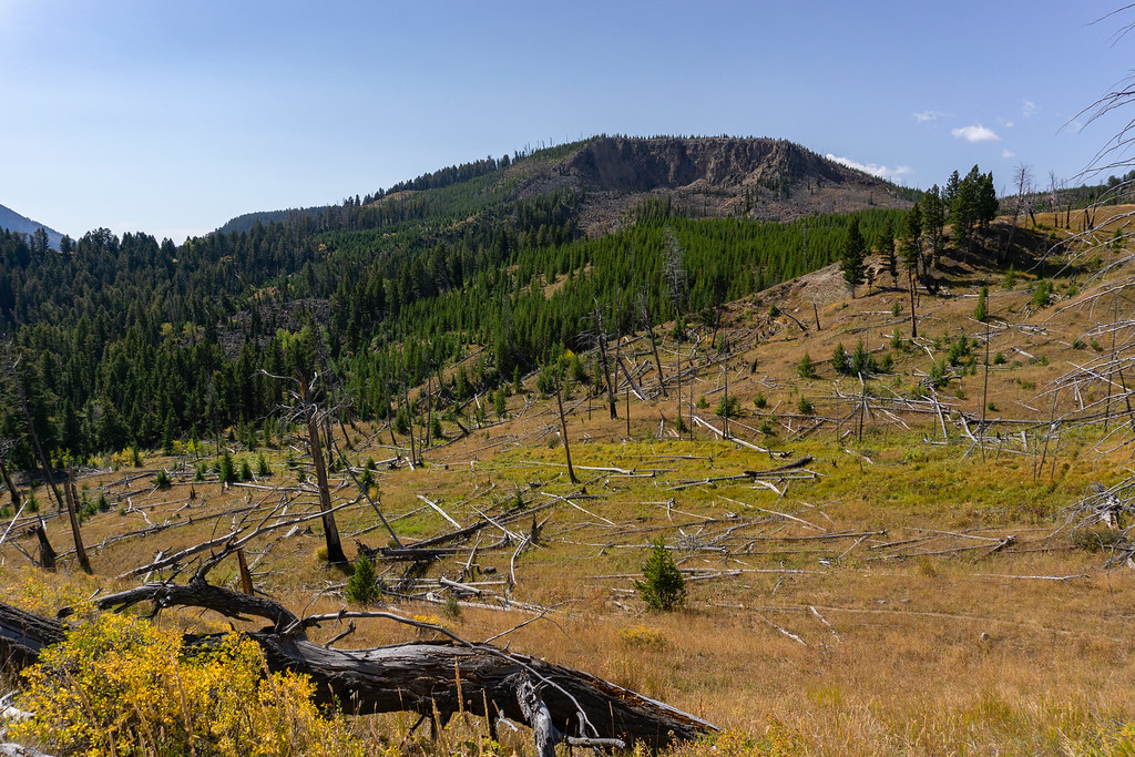
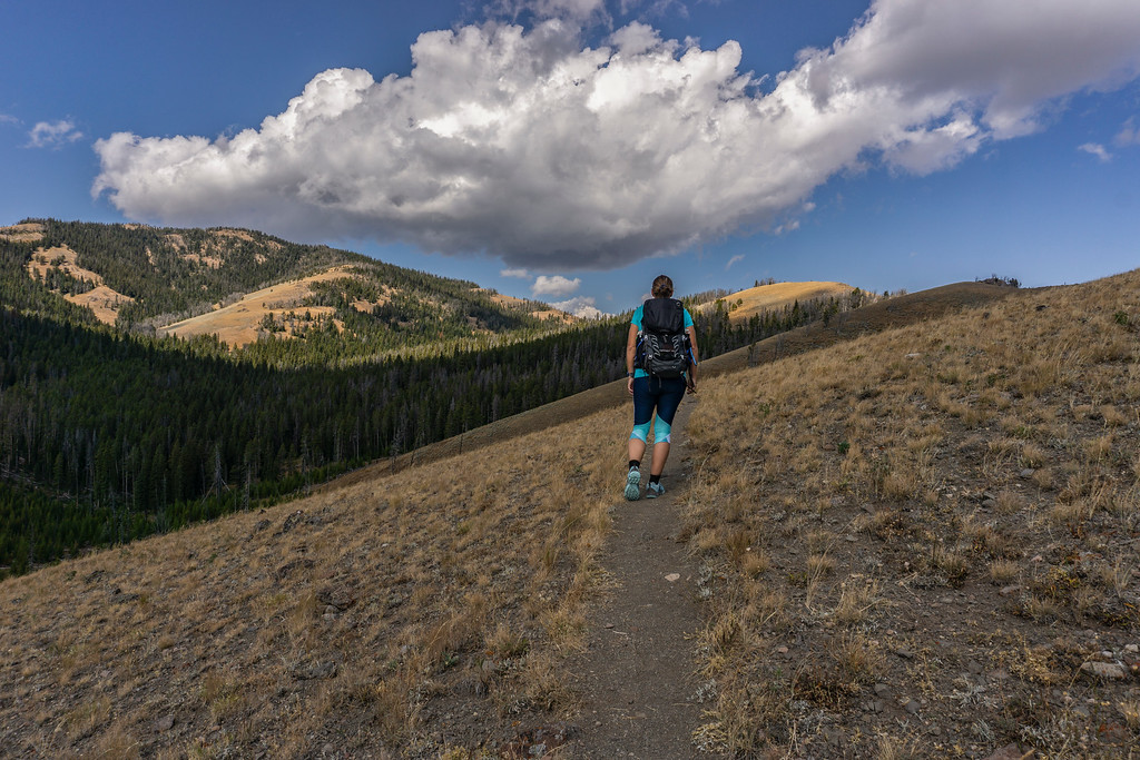
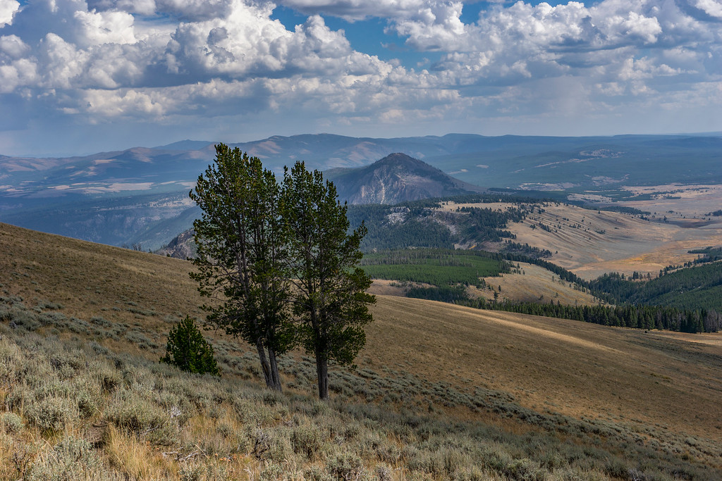
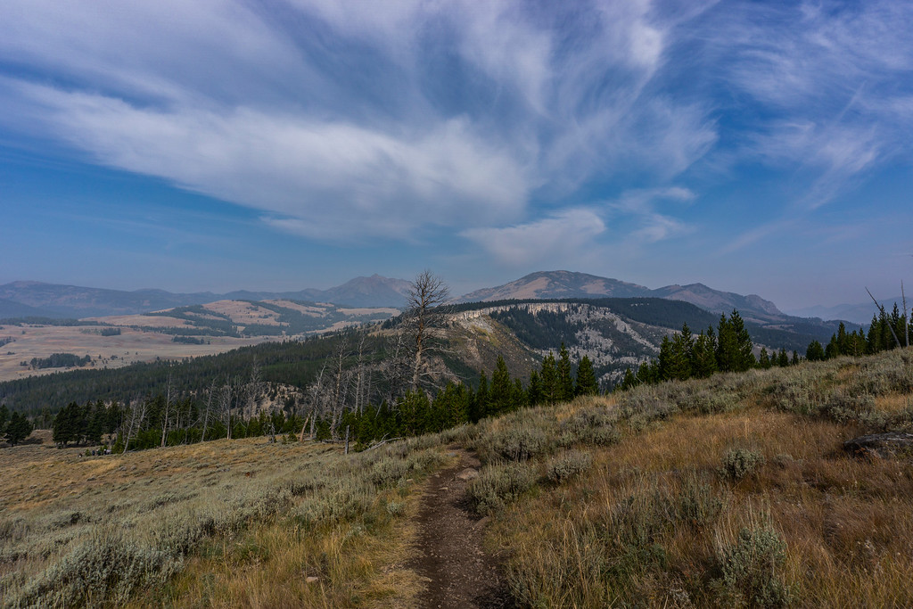
I packed my daypack and was ready for the first hike of the day. Mammoth campground is pretty awesome. I could just leave my car there and walk the footpath up to the geothermal areas and to the trailheads. That’s exactly what I did. My first hike in the park was Beaver Ponds loop, a nice and easy 5.4-mile loop through rolling hills and sagebrush areas. I used the trailhead near Liberty Cap in the Mammoth area.
Several trail junctions followed within the first half mile and the trail climbed up a bit, revealing pretty amazing views towards the North and Gardner Canyon. It was a bit hazy because of the Bacon Rind Fire nearby but not as bad as I thought. Air quality was a big issue to me as my lungs were damaged by the volcanic eruption in Hawai’i and I often had a tough time breathing. At least my lung capacity was back to 80%, really amazing progress from where I originally started. I just had to take it slow.
Looking to the northeast
I was more than once out of breath, catching air. But at least I got to stop frequently to take in all the scenery. It was more than beautiful. The first hike in Yellowstone and the first time for me to hike in bear country with a high chance of bear sightings. After feeling a bit awkward for the first mile I felt more comfortable and finally it felt like any other hike I’ve done in my life. I was bear aware and had my bear pepper spray on my chest strap, ready to use if needed.
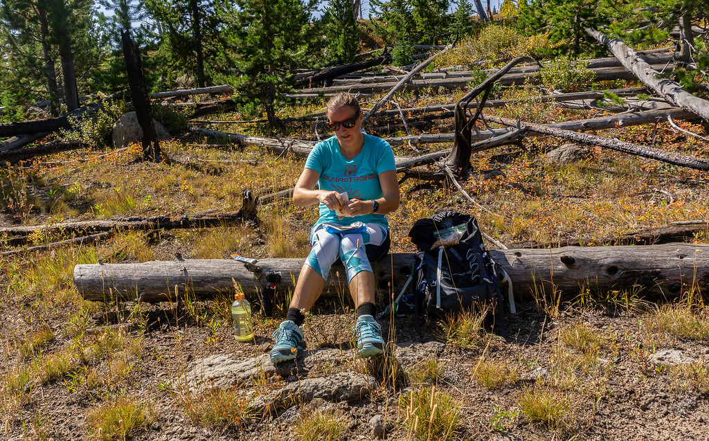
Eventually, I reached Beaver Ponds and enjoyed a nice lunch at a glacial boulder.
Two hikers passed me, they were the only two visitors I saw on the trail. That’s how I like it.
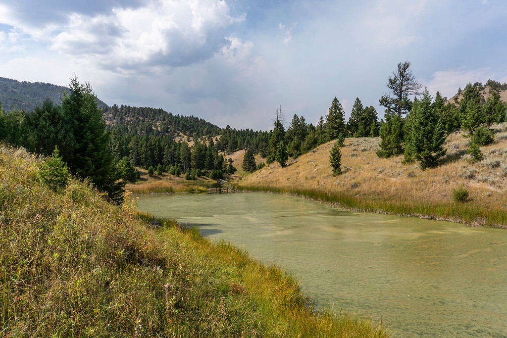
Beaver Ponds
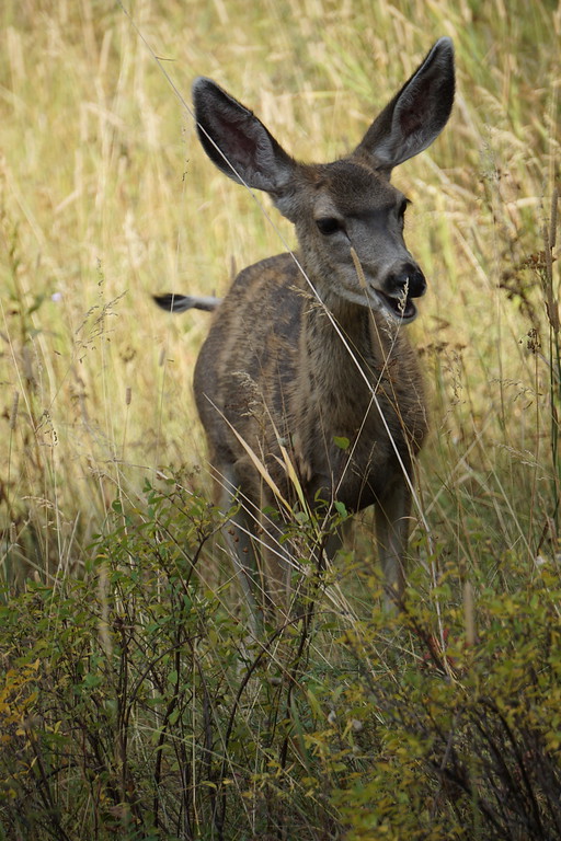
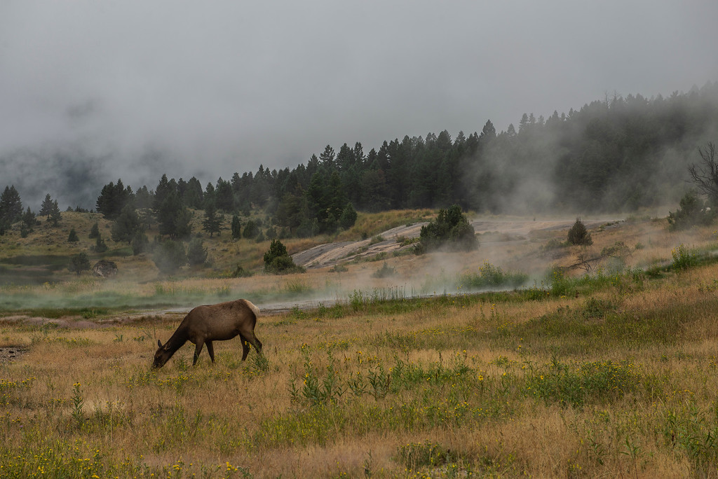
On the way back I saw several deer relaxing in a shaded spot and passed them without spooking them away. Wow, that was a first!!! Normally I’m a wildlife repellant and everything runs and hides as soon as I come nearby.
The trail back followed the old Gardiner Road and ended at the Mammoth Hotel.
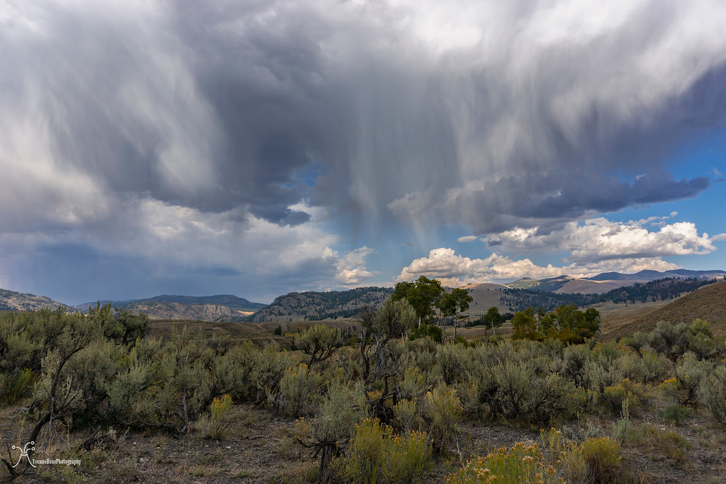
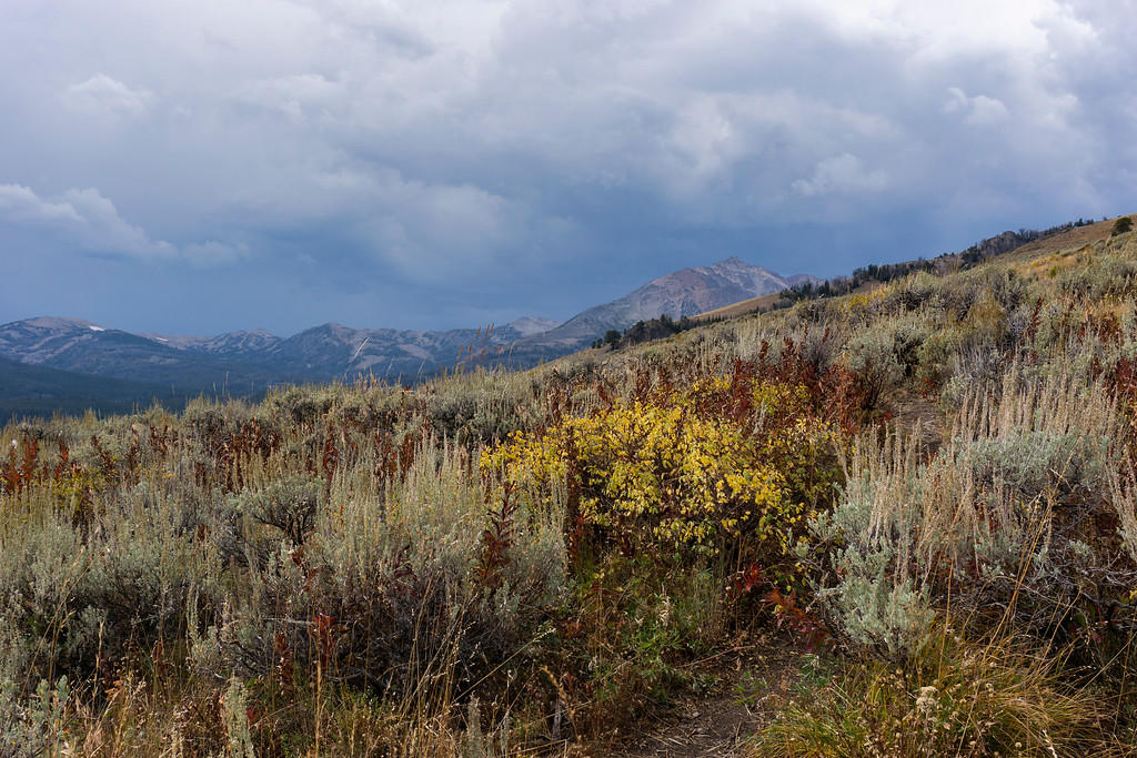
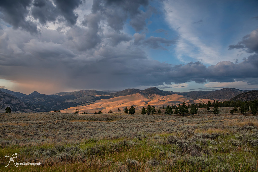
I headed back to the campground and picked up my car. It was still early in the day and I had a lot of energy left to explore. So I headed towards Lamar Valley. The first detour was at Blacktail Plateau Drive. This one-way scenic drive offered outstanding views and I really enjoyed the scenery while a small storm was passing by.
As soon as I passed Tower Junction and went across the Yellowstone River, I encountered the first bison jam. Luckily it didn’t take too long to pass and I stopped several times along the way at some pullouts to take in the scenery. The small storm nearby was really cool and created some awesome dramatic clouds.

Bison Jam
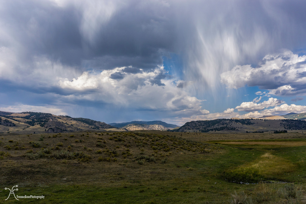
Dancing Virga of a passing storm
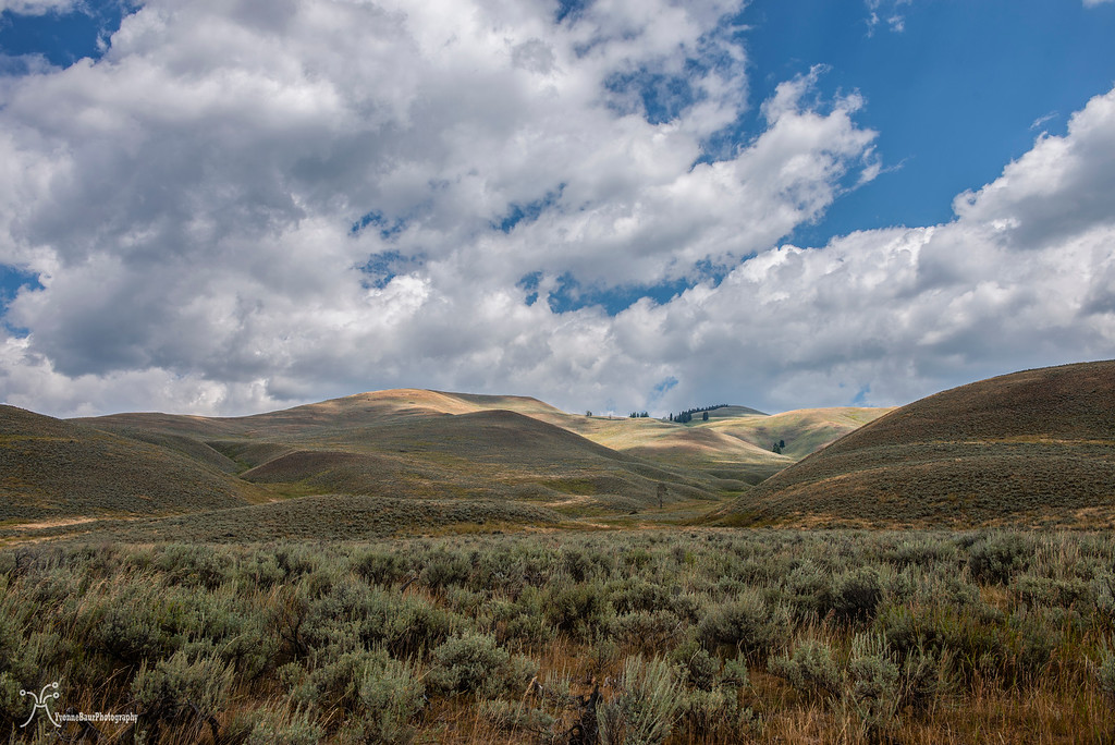
The rolling hills of Lamar Valley were absolutely awesome. I stopped over and over again, enjoyed the interplay of shadow and light. I was a scene I had envisioned for a long time.
At one point I turned around and headed back, as I wanted to shoot sunset at Mammoth. The bison jam was still there and got stuck a second time before I could continue. The cool thing about the bison jams is you get to see these impressive beasts close-up from the safety of your car.
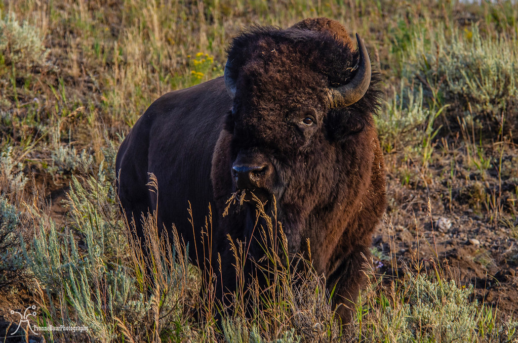
And they walked all over the place between cars and on both sides of the road. It was pretty cool.
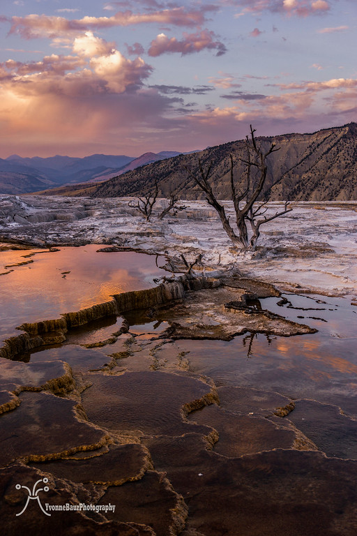
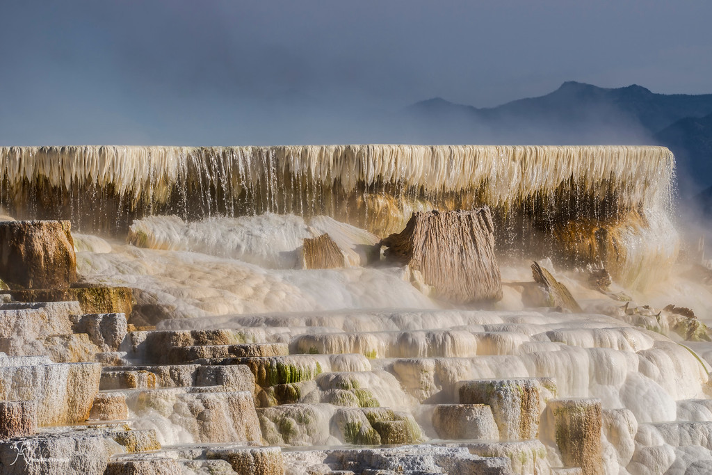
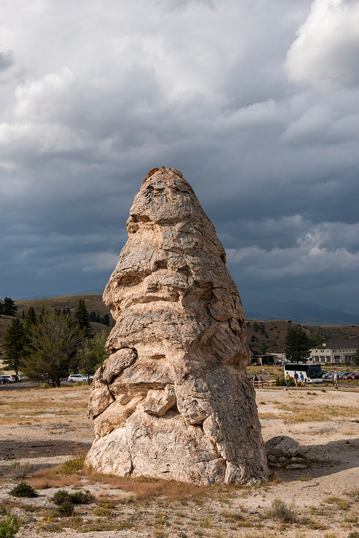
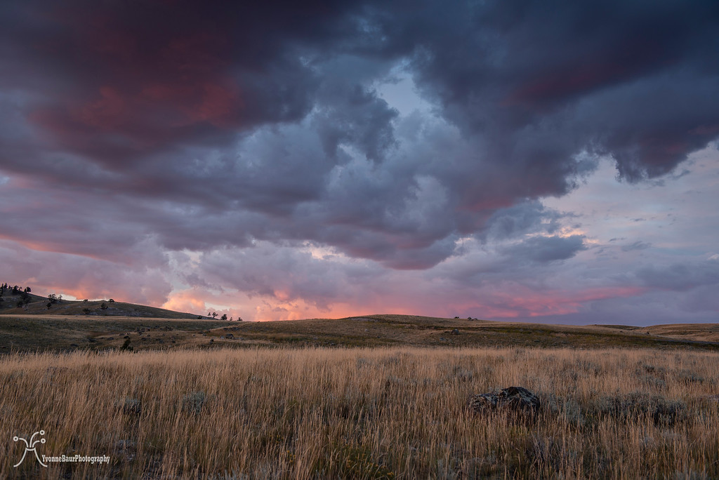
Back at Mammoth I parked at the Lower Terrace parking lot and walked up all the way to the big pool near Canary Spring. There was a dead tree in the travertine covered terrace and it was a perfect foreground.
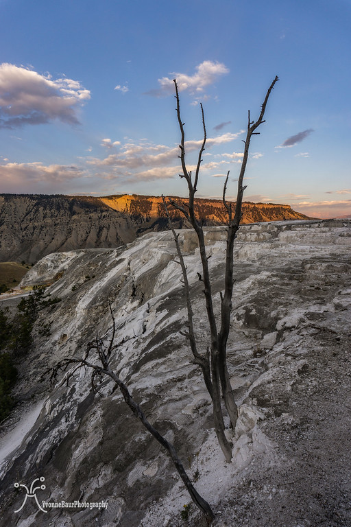
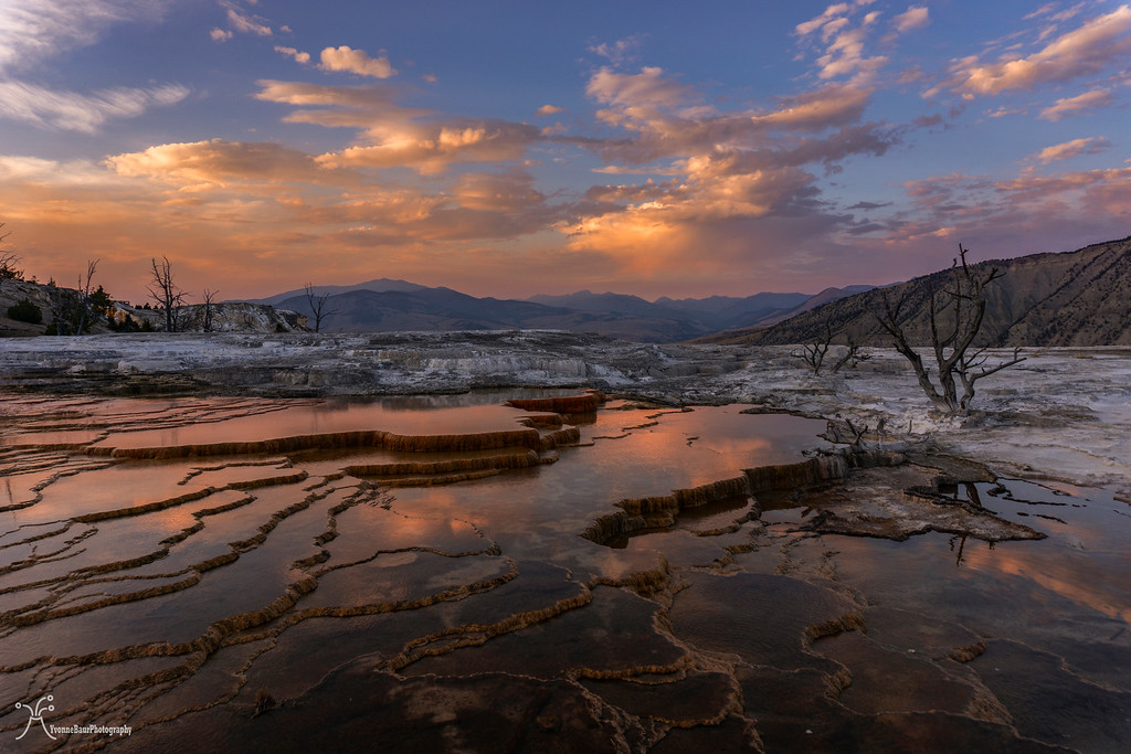
Sunset was absolutely amazing, thanks to the Bacon Rind Fire and the smoke in the air.
I couldn’t be happier.
A quick dinner at camp followed and another sleepless night. It was one of the issues I had to deal with since my experiences with an erupting volcano and imminent danger day and night. I simply couldn’t calm down and relax now that I was safe for several weeks. I guess this will take a lot of time. Instead, I listened to the sounds of Coyotes, a Great Horned Owl, and bugling elk in the distance. Sleep would have been really appreciated, but the sounds of nature were pretty nice as well.
Total miles: 8.4
September 8:
I finally dozed off in the predawn hours and got up at 6:30 am. A brilliant and new day was waiting and I was ready to explore and hike. The weather forecast was perfect with no chance of storms, so I decided to hike up Sepulcher Mountain today. It would be one of the toughest hikes I had planned.
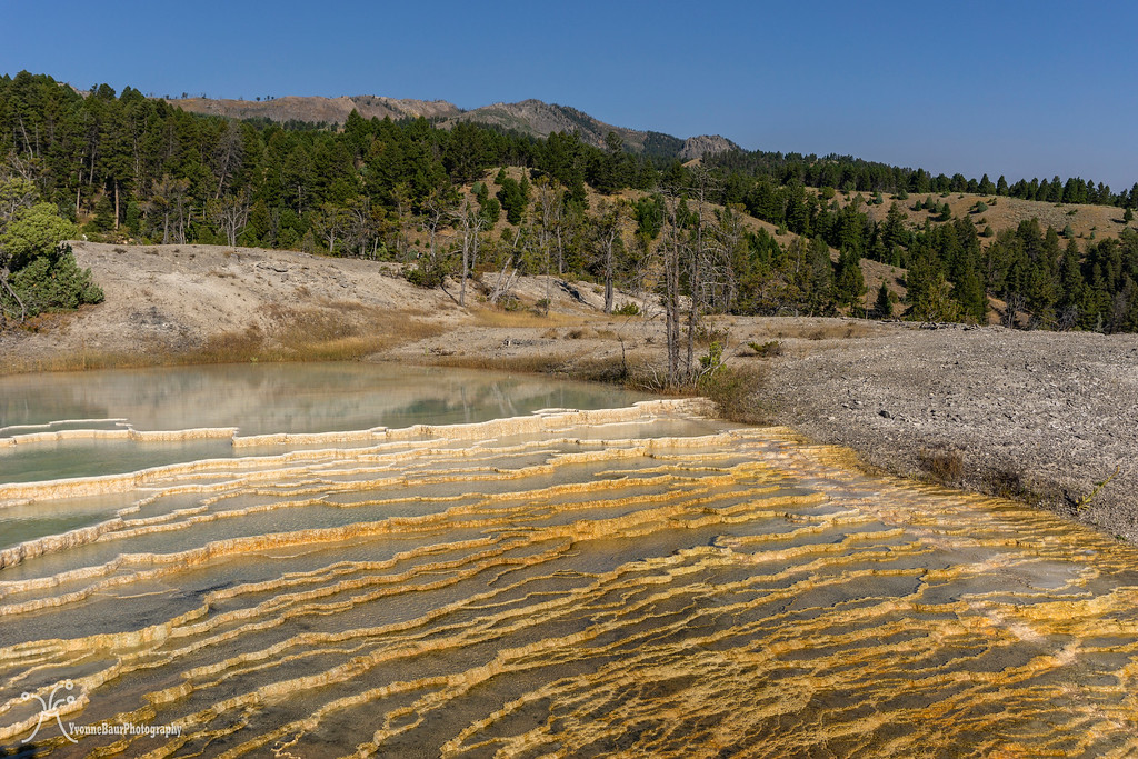
I had breakfast, packed my day pack, and started to explore. The first action of the day was exploring the Mammoth Hot Springs Terraces. Nice boardwalks let a visitor safely walk to all the interesting geothermal areas.
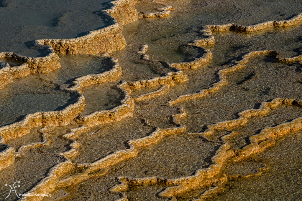
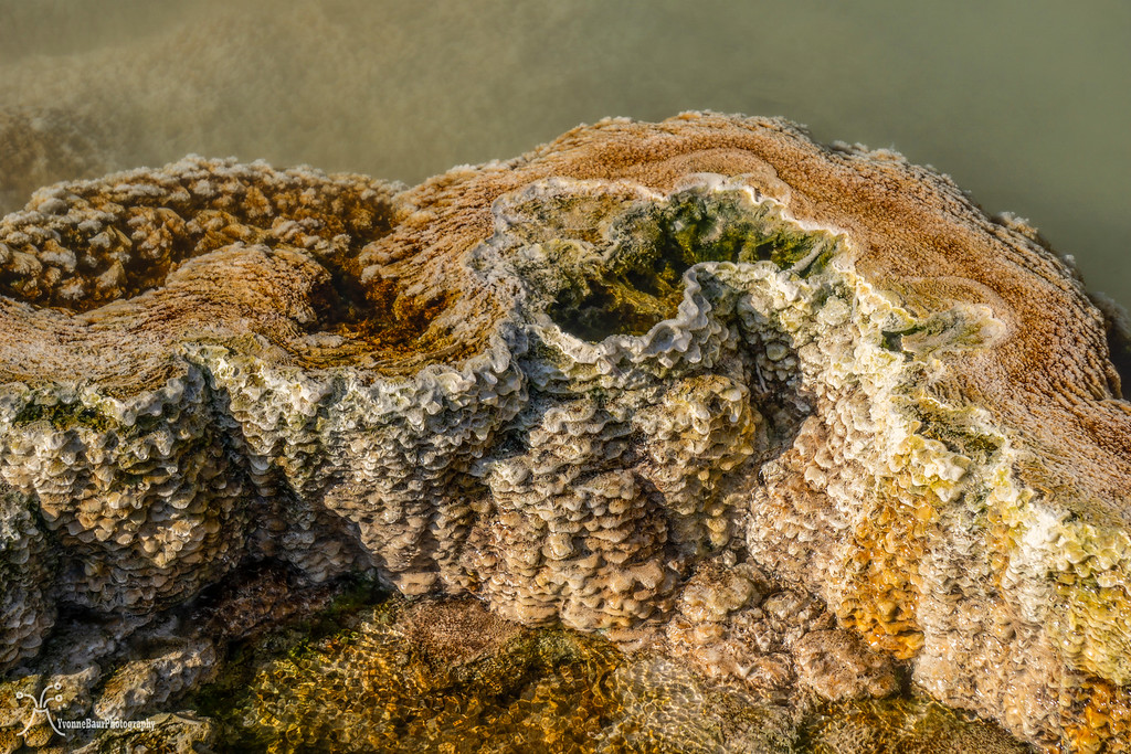
The travertine created wonderful abstracts in all colors and variations. It was really amazing and I read that it didn’t need a lot of time to cover something up in travertine.
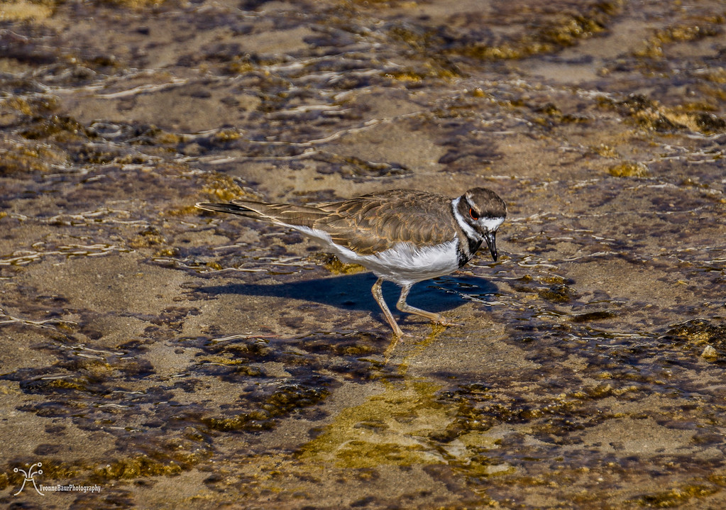
Killdeer
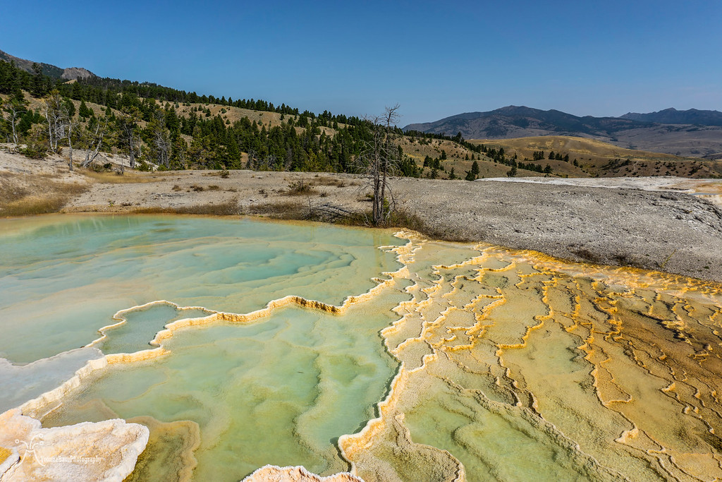
Canary Springs was a pretty amazing sight as well as all the other geothermal features.
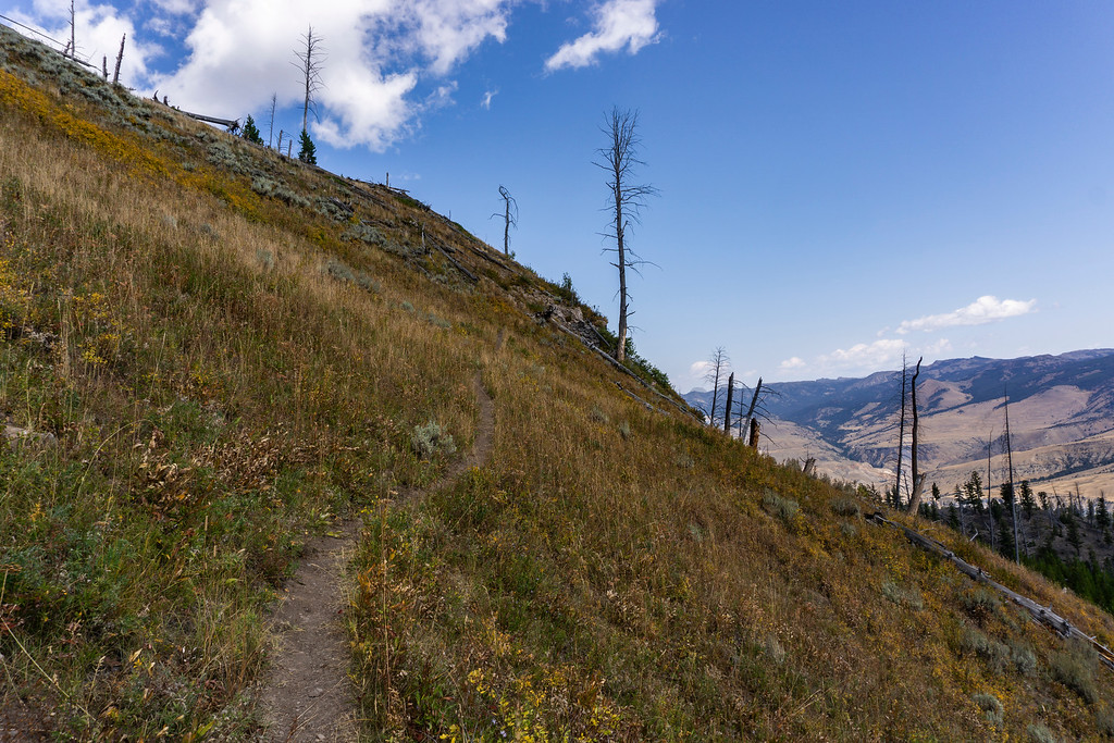
About an hour later I decided to get started on my hike. Sepulcher Mtn. trail is about 13 miles long with about 3,200 ft. of elevation gain. This would be a tough one for me but I really wanted to do it. Under normal circumstances I would be fine but with my limited lung capacity it would be really tough to do so. I was ready. I needed to find my limits.
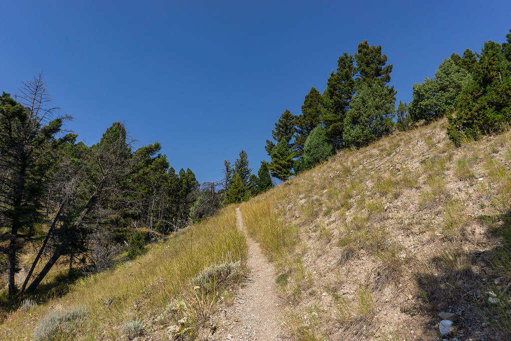
The trailhead was the same as Beaver Ponds but split up after about a mile. As soon as I turned left on Sepulcher Mountain trail, I started to gain elevation.
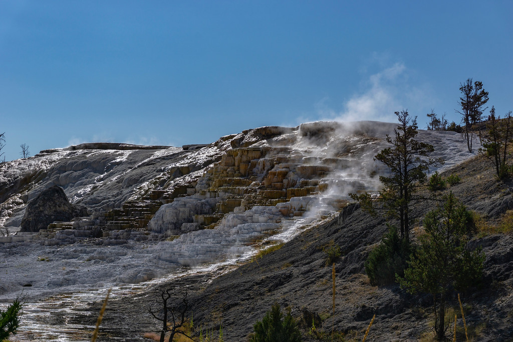
the trail starts next to the terraces
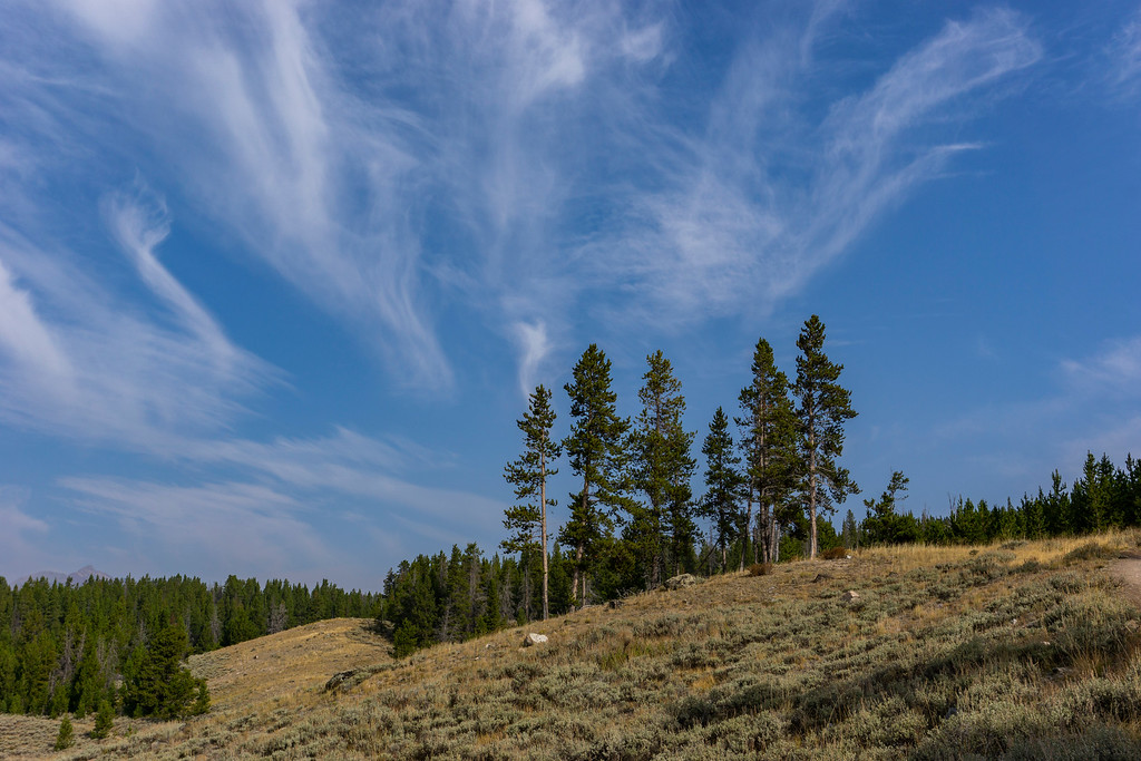
I took my time. The trail went through a forest of Lodgepole Pines; they were spared by the 1988 fires. I heard elk bugling in the distance, enjoyed the scenery.
after the junction, the trail goes through a forested area
On a small plateau surrounded by deadfall, I had an early lunch break.
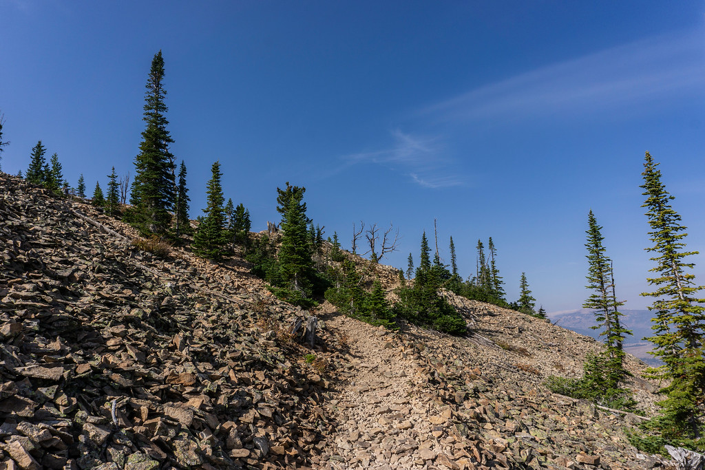
Soon after I left this spot the trail began tremendously to start to climb. Higher and higher I went, huffing and puffing and coughing. I guess with all that noise I did not have to worry about Grizzly at all. The trail is one that is prone to a lot of Grizzly activity and signs were obvious everywhere. Scat, scratch marks, even the smell of bears was here. I reached a saddle between the climbs and enjoyed the relatively flat section.
looking to the northeast from the trail with Mount Everts
a flat section of the trail
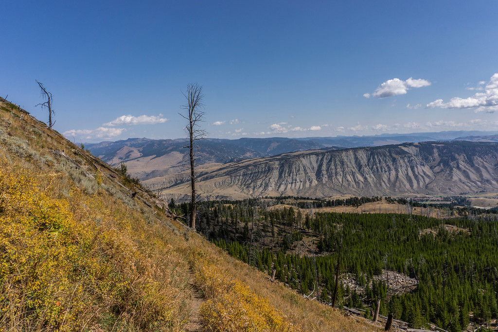
This hike was a leg burner for sure and with the lack of sufficiently taking in oxygen, it was tough. I had to stop a lot of times because I couldn’t get enough air fast enough. I pushed harder, I just wanted to do it. I never give up and I definitely wouldn’t do it on this hike. The next forested section followed, full of scratch marks on several trees. I climbed higher and eventually the first views down towards Gardiner came into sight.
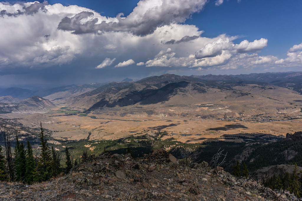
The Absaroka Range, Gardiner from above
It was pretty cool and definitely worth all the effort. Another short but steep climb followed and I reached the first bluffs made of volcanic tuff. To the west was Electric Peak, the highest peak in Yellowstone. One day I would go to the top of it as well.
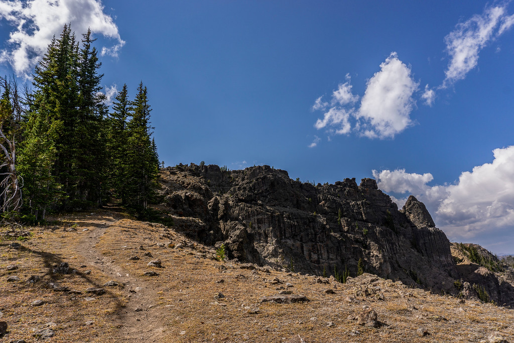
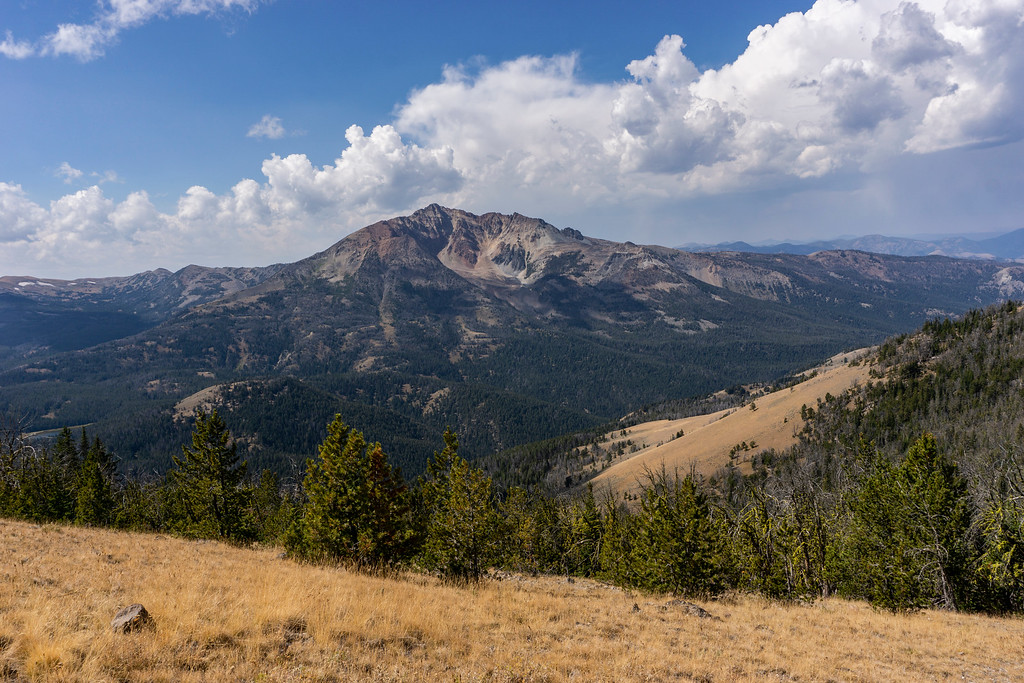
Electric Peak

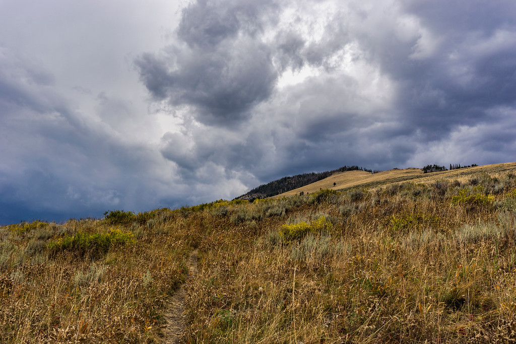
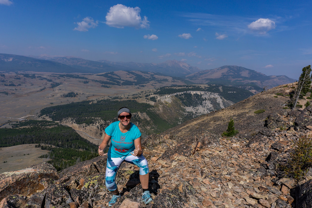
I enjoyed the views at the summit of Sepulcher Mountain, finally, I made it. Some dark clouds were in the distance and I checked the weather forecast. The radar showed they were moving in the opposite direction and I relaxed a bit. I wouldn’t want to be up here during an electric storm.
The hike down followed the south flank of Sepulcher Mountain, a steep down climb with a lot of switchbacks and elevation loss. Most of the south flank was without any trees and sagebrush dominated the scenery.
The south flank of Sepulcher Mountain with Bunsen Peak in the distance, Gardner's Hole and Swan Lake Flats
I was halfway down when I heard the first rumbles of thunder.
I checked the radar and a storm cell had popped up and was moving pretty fast into my direction.
This was not good. I started to hurry, almost running down. I definitely wanted to make it down to the tree line before the storm hit. The storm moved in faster and I tried to walk as fast as I could. Not easy when you can’t breathe pretty well.
Eventually I reached Glen Creek and Glen Creek trail. I still had a few miles to go. But finally, I was at timberline again. The storm hit with full force and a gust front created strong winds with lightning.
I walked through the forested area and all of a sudden I heard all these booms!!! I froze in my movements, puzzled what it was. Had lightning hit a tree and it just exploded? Another boom, this time closer. And then another one, this time the earth trembled. That was scary!!!
I finally figured out what it was. It was deadfall crushing down to the ground. The strong winds took a good toll on all the dead trees!! I definitely did not want to stay here, that was scarier than an electric storm. I picked up the pace and pushed forward, as fast as I could. It rained and hailed but I still had a few miles to go. No more pictures, I just kept moving on. I went across Snow Pass, it rained but the storm moved on.
What an adventure!! I reached Upper Terrace of Mammoth, saw some elk, and had some moody scenes.
Liberty Cap - finally back at the trailhead
The rain lifted and the sun came out again. After that hike, I was up for a little break and had a siesta at camp. Later I went to shoot sunset and ended up in the meadows near Blacktail Deer trailhead. It was still a bit stormy but that created another amazing sunset.
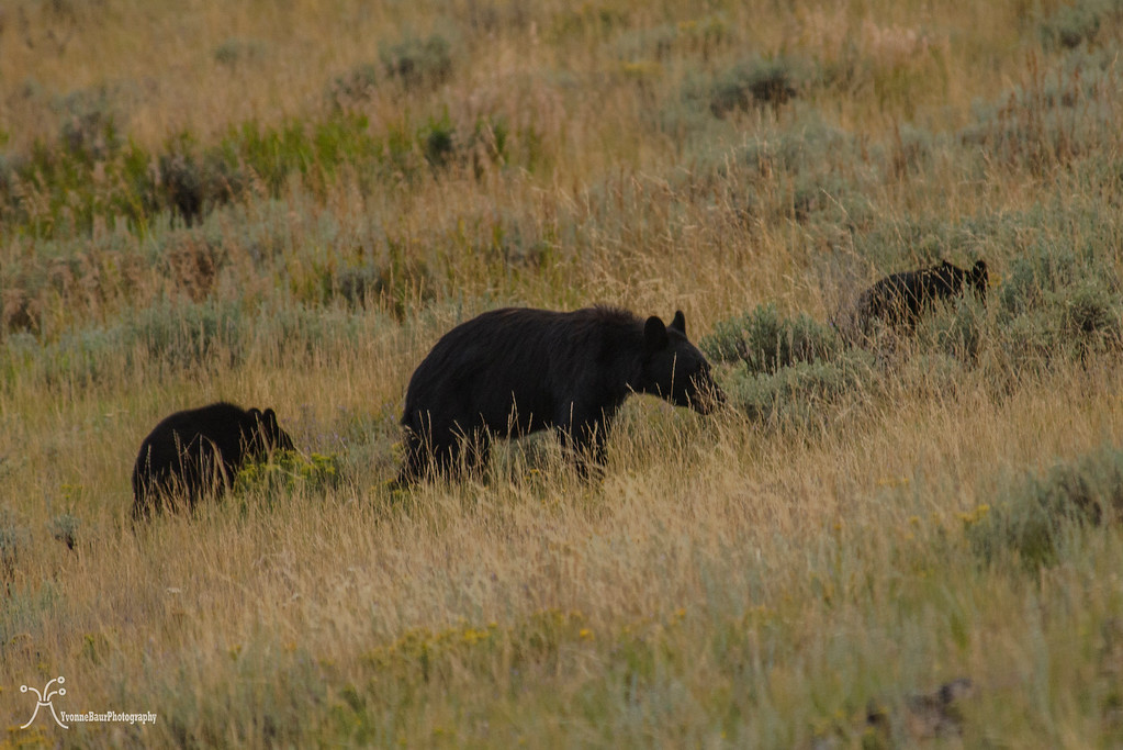
Some of the boulders in the meadow seemed to move which was weird. I finally figure out that it was a black bear and her two cubs, pretty funny. It didn’t take a long time and my wonderful sunset location was swarmed by tourists who also saw the bear. Time to head back to camp and to take a shower at the Mammoth Hotel.
It was a long but amazing day. And I went up Sepulcher Mountain.
Total miles: 16.05
September 9
While I was here at Yellowstone, I had posted some stuff and how grateful I was to be here. One of my former neighbors in Hawai’i saw my post and said she would be here for the next three days. I called her and we decided to get together tomorrow. What a small world!!
After the long hike yesterday I decided to do something shorter today. Bunsen Peak and Osprey Falls came into my mind and that’s what I wanted to do today. I had another early start due to the lack of sleep.
When I first opened my tent I looked straight at the butt of an elk cow!! Okay, welcome to nature I guess. It was pretty funny. I opened the other door of my tent and all was clear, haha.
I had a quick breakfast and packed my day pack for my hike today. Interestingly I was not sore at all from yesterday’s climb and more than ready to hike.
The trailhead was already pretty packed with cars but I barely saw anyone at all on the trail.
It was a really hazy day today and views were not the best. I thought all the rain from yesterday would have cleared the air but it was the opposite.
Bunsen Peak Trail is a short but sort of steep trail and obviously pretty popular as well.
The views towards Swan Lake Flats to the south and Golden Gate Canyon were awesome. I loved every turn of the trail and its never-ending views.
Golden Gate Canyon
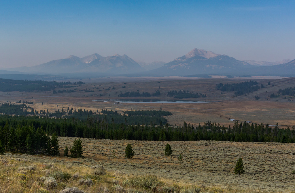
Swan Lake and Electric Peak to the right
Half of the top part of the trail was on scree, but it was a fast climb up. I passed a few hikers on my way up. I was surprised that even with my limitations I was faster than they were. I reached the top and enjoyed the views.
I made it to the top
I decided to continue to Osprey Falls as it was still early in the day. The trail went down the southeast flank of the mountain, which was severely burned by the 1988 fires. Eventually, I reached the Bunsen Peak Road and followed it a little bit before I turned onto Osprey Falls Trail. The trail winds down to the Gardner River where the water has created a dramatic canyon called Sheepeater Cliffs to the east.
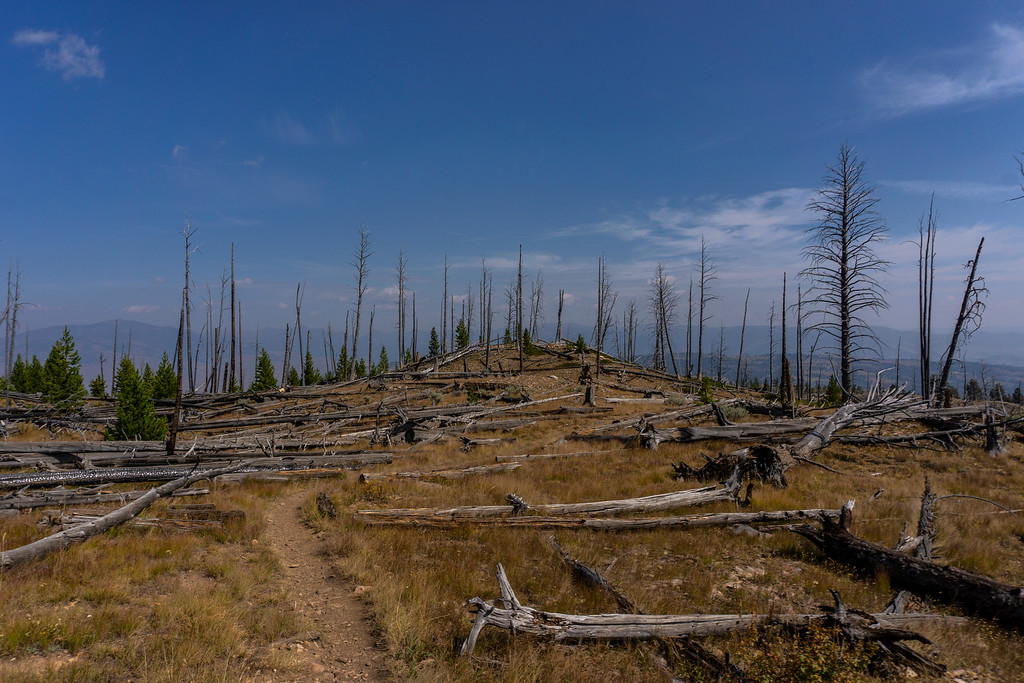
Burn scars
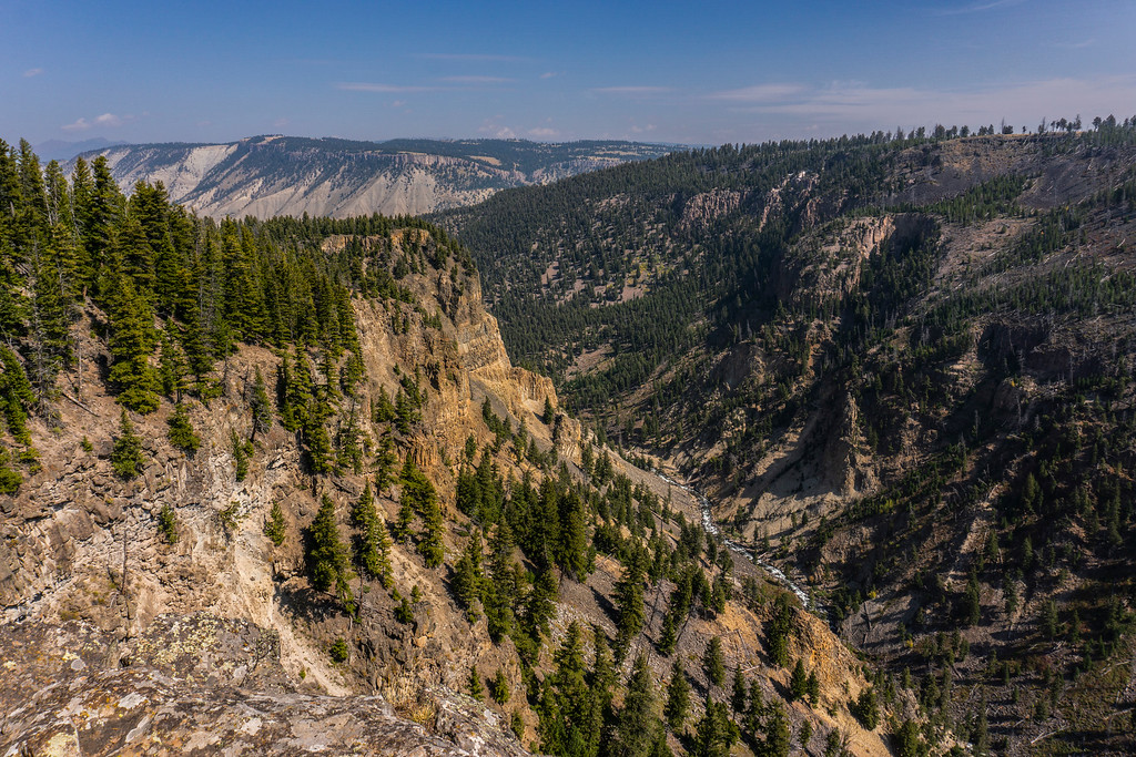
Gardner River below
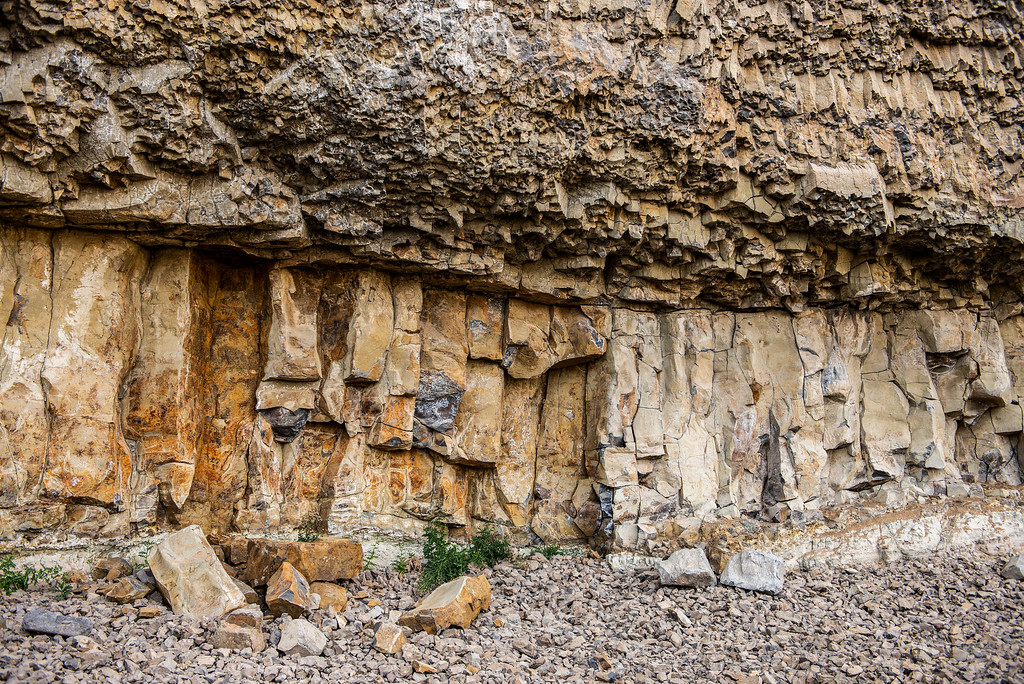
Columnar joints of basalt show the fiery history of this place when basaltic lava erupted and created several hundred feet of lava rock.
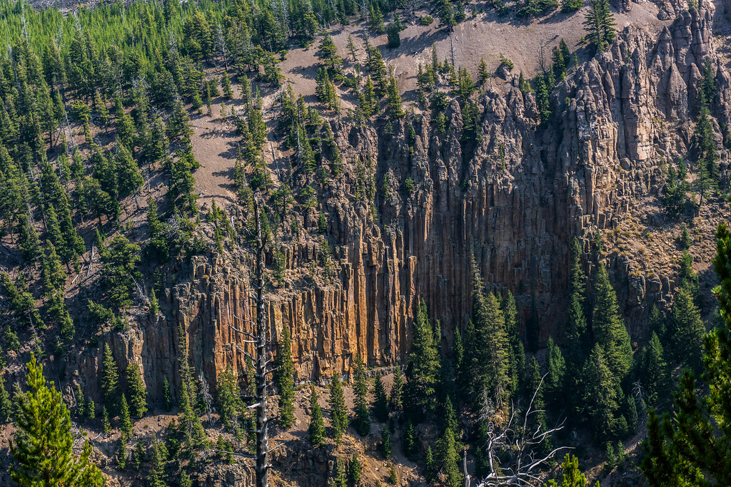
Columnar Jointing
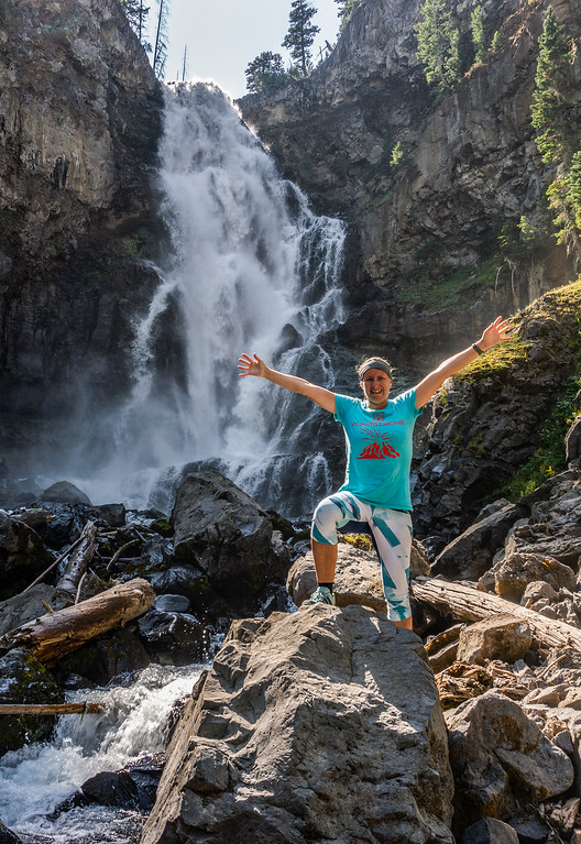
Eventually, I made it down to the river and enjoyed the waterfall which was pretty impressive. Half an hour earlier and it would have been completely in shade. It was fun anyway and the water was pretty refreshing. I couldn’t resist and dip my feet into it.
After a nice lunch break in the shade I slowly worked my way up. At the trail junction I turned left and followed the old Bunsen Peak Road, now a bike trail, back to the trailhead. It was super pretty, with open meadows and patches of young Lodgepole Pine trees.
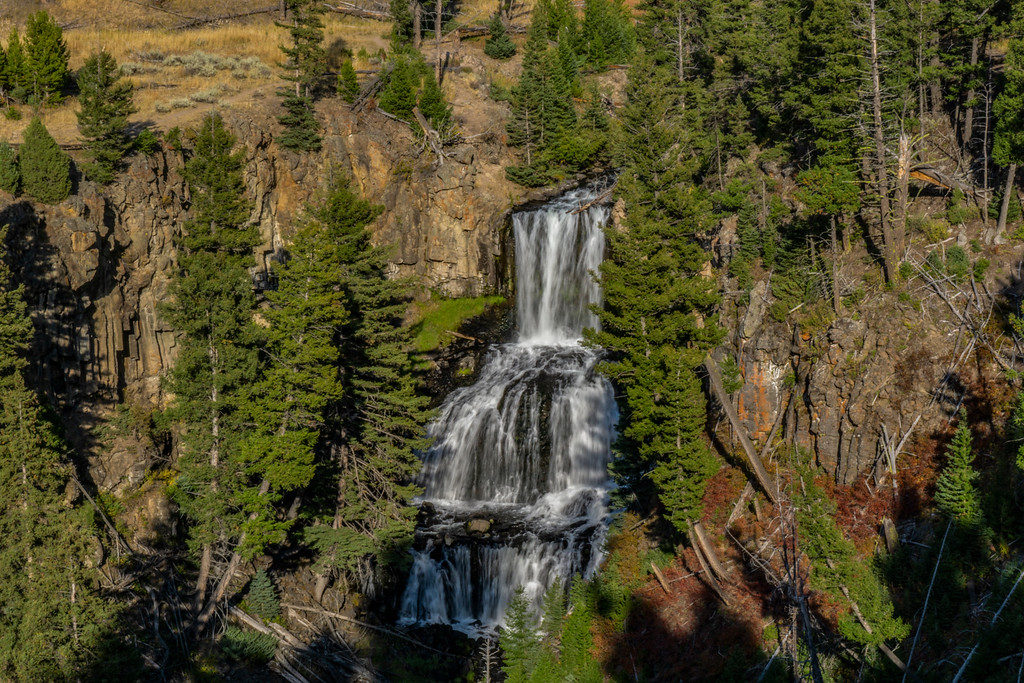
Back at the trailhead I decided to do a bit of touristy stuff and explore the area. My first stop was Undine Falls, a pretty waterfall embedded in the volcanic rocks and rolling hills of the Lava Creek trail.
The light was really pretty and I enjoyed the view.
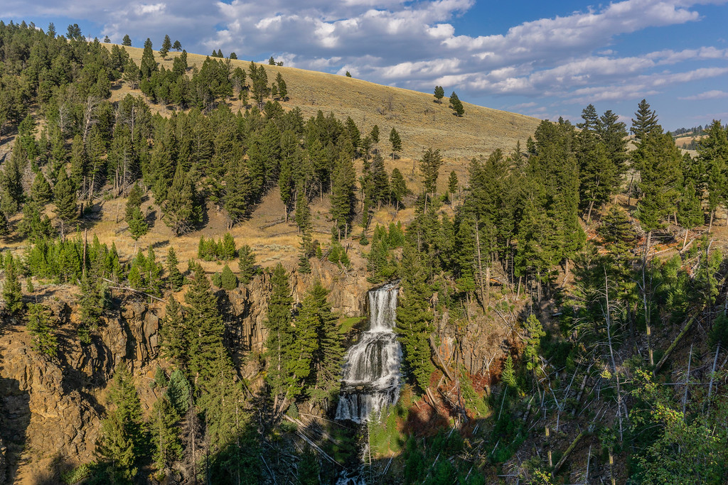
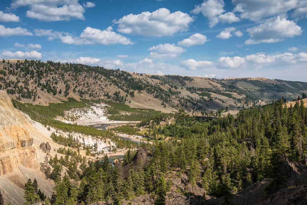
I continued towards Tower junction and went to visit Tower falls. On the way I stopped at several viewpoints and enjoyed the views of the Yellowstone River near Bumpass Butte as well as the massive columnar jointing next to the road towards Tower Falls.
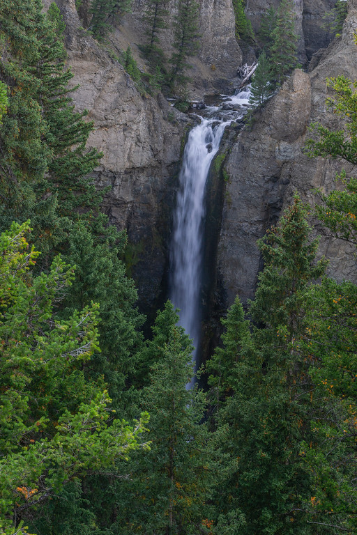
Tower Falls itself was a short walk to a viewpoint and didn’t take long.
The volcanic tuff above the falls had taken its toll to erosion and looked like small rock towers.
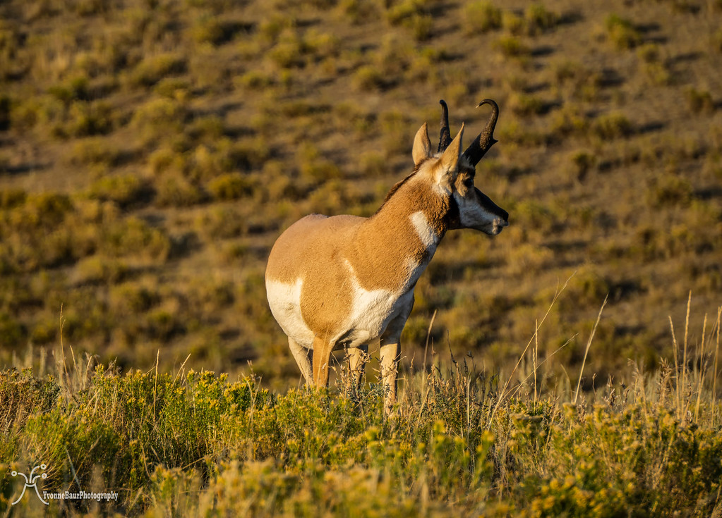
From here I headed back to Tower Junction and to Lamar Valley. A lot of bison and Pronghorn were out in the field and I enjoyed watching them from a safe distance.
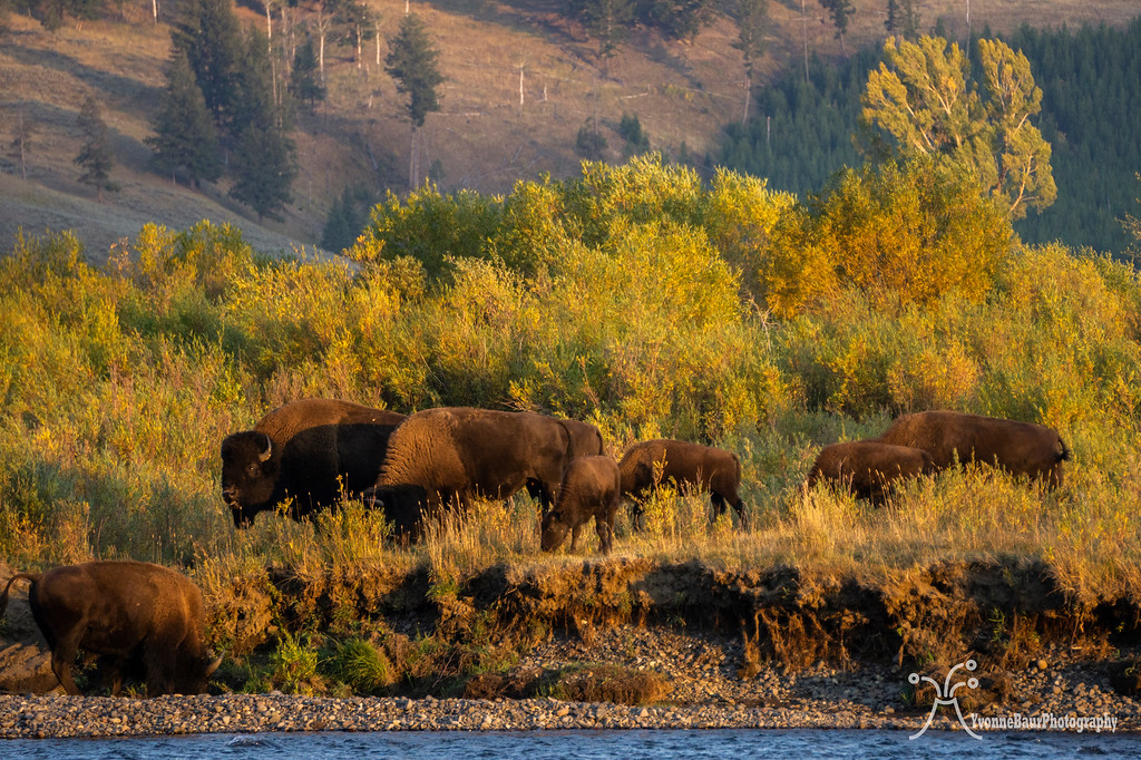
A few times I yelled at some Asian tourists who stopped in the middle of the road to take pictures. The next pullout was just 30 feet away. Some people never learn how to behave in a park. At least they didn’t harass the bison.
Back at camp it was a more relaxing evening today. No sunset shots, nothing else. Just a bit of time to slow down. Tomorrow I would move on to Madison campground and new hikes and explorations would wait for me.
Total miles: 14.4


No comments:
Post a Comment